Original story written on 1/11/2009:
All the original details still hold: the last-minute planning, the freak swells, the duct-taped hood. The boats were slower back then, fuel was cheaper, and West Marine probably still opened on Sundays… but the ride?
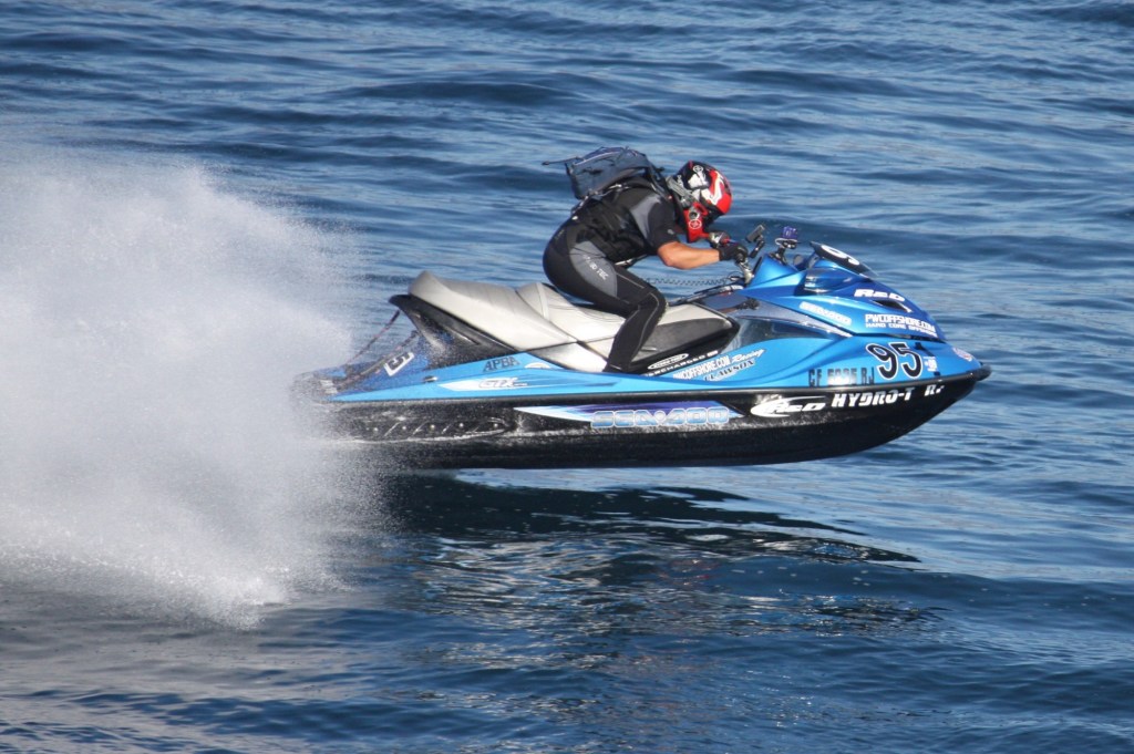
Same rush. Same salt in your eyes. Same idiot wave you throw when a bird dive-bombs you. Nothing’s changed—except maybe how loud the Santa Anas sound when you’re pushing eighty on a Kawasaki Ultra. Classic…
How do you plan your rides? Is it a quick call to rally the crew or a long, chaotic thread with endless replies where no one knows who’s showing up or where you’re going? I’m not judging—those messy plans got me hooked on riding, and they’re great for getting newbies out on the water. Lately, though, our group’s approach is simpler: want to ride? Be at the start point Sunday morning. Don’t show? Guess you’re sitting this one out.
This Sunday’s pwcoffshore.com training ride was set for 7:30 a.m. at the Long Beach launch ramp, with Avalon as the tentative destination. But with Santa Ana winds forecast to gust up to 70 mph along the coast, we scrapped Avalon for a 220-mile round-trip to San Diego. And just like that, the adventure began.
One mile in, Lee’s supercharger started slipping. John Belton tested Lee Pham’s Sea-Doo to confirm, and we called the legendary Mr. Friebe, the go-to Sea-Doo guru.
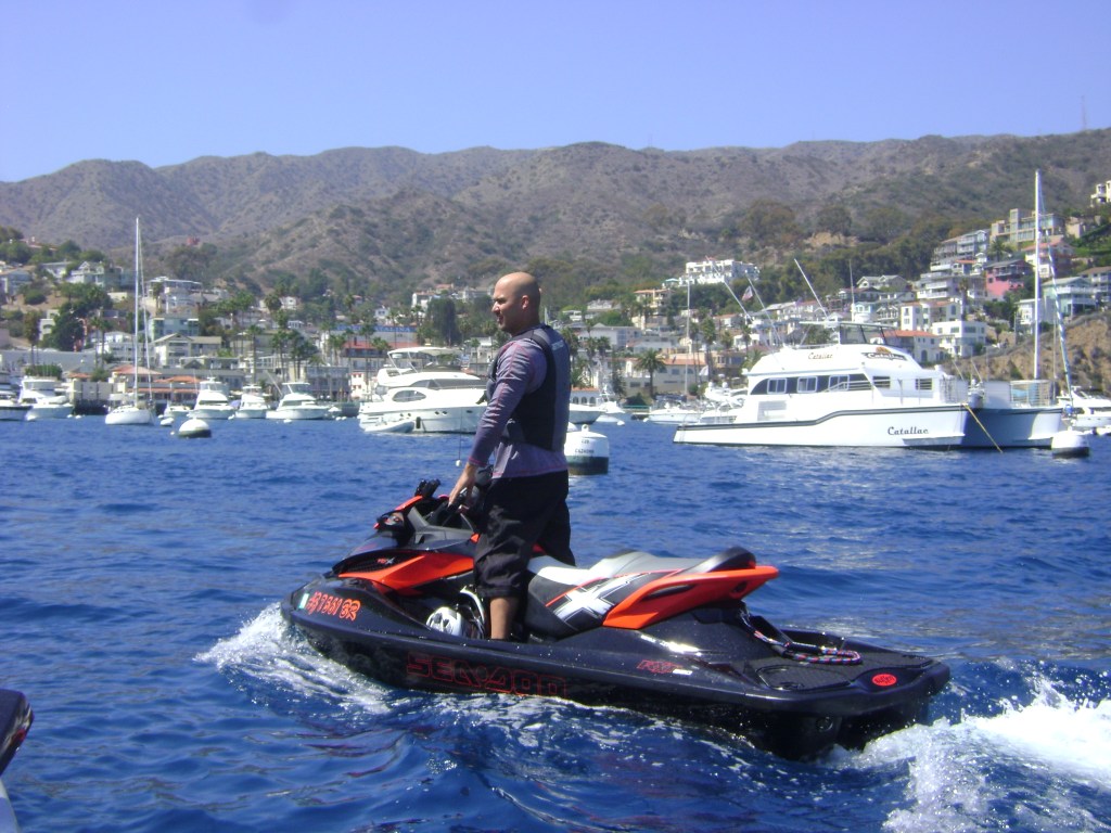
Picture this: three of us drifting gently near the Long Beach breakwater and an offshore oil rig, calm seas, clear skies, Catalina in view, the sun blazing, and the moon still hanging in the west.
Those Santa Anas sure clear the air. Friebe, reportedly answering from his morning shower, confirmed Lee could ride but not at full speed. So, John and I waved goodbye as Lee limped back to the launch ramp.
The Santa Anas calmed the coastline, making it a smooth, soul-soothing ride—definitely not a surfing day. John stuck close to shore while I took the direct offshore line, cutting up to 3 miles on one leg, according to my GPS.
We rode wide-open throttle (WOT) until John, worried about fuel, slowed down. I kept a steady 50 mph, and we opted for Mission Bay over San Diego Bay for fuel.
You can make it from Dana Point to Mission Bay—barely—with about a gallon to spare. Both fuel docks only had 87 octane, so we grabbed octane boost, hit the deli for lunch, and noted the West Marine was closed (who closes a marine store on Sunday?).
With just two of us, wingman roles were clear. Near a massive kelp field, I went offshore while John hugged the coast. I thought he’d get tangled and turn back, but he powered through, and I played catch-up. This back-and-forth game continued all the way down and back.
My GPS navigation shined, but John’s coastal route sometimes won out. Mission Bay was our fuel stop, and San Diego proved itself a boater’s paradise with free launch ramps. I grabbed waterproof maps for future rides, not knowing we’d log 220 miles that day.
Fuel stops were Dana Point (southbound), Mission Bay, Oceanside, and Mission Bay again (northbound).
I always carry a gear bag and one VISA card in my vest’s zipped pocket for fuel and emergencies—no cash needed. The morning was a last-minute scramble: up at 6:15 a.m. after a midnight return, grab the gear, hook the trailer, unplug the battery, and go. Sundays are ride days, and the routine is dialed in.
Every good ride has a “pay the piper” moment, and this one was no exception. On the return, freak swells hit after Oceanside, slamming my hood and breaking it.
Out came the military grade duct tape from my glove box to secure it. At Oceanside, I noticed that it held rather nicely. No slowdowns. While racing John back, my tape started peeling, but I kept pushing, not wanting to lose my lead. He didn’t even notice my hood drama until we stopped.
Other highlights? Clearing kelp from the jet ski, practicing the offshore “WAVE” (stand, grip the saddle, wave with one hand like a pro), and even handling a mid-ride bathroom break (trickier than it sounds, learned from ultramarathon tips).
The WAVE is great for signaling control to boaters or fishermen, but it didn’t help when saltwater stung my eyes or a bird flew into my goggles. The return to Dana Point was rough—big seas, no waving, just pounding waves.
At the Long Beach finish, I took the lead, only to get stuck in a channel at an ultra-low tide, wrapped in red vine-like rope. I hopped off, pushed the ski free, and made it to the docks, which were nearly dry.
Tips for Planning an LA to San Diego Ride
Here’s a breakdown of the coastline to help you plan better than my last-minute adventure:
- Point Loma Light (32°39’54”N, 117°14’33”W): 88 feet above water, with a fog signal. Watch for kelp beds extending 1.5 miles south. Landmarks include a red-and-white checkered tank, green standpipe, and lookout tower 2.5 miles north.
- Ballast Point Light (32°41’10”N, 117°13’57”W): 16 feet above water. Naval Submarine Base piers are just north. North Island (Naval Base Coronado), Coronado’s tall condos, Hotel del Coronado, and Naval Air Station tower are visible.
- San Diego Restricted Areas: Avoid the lee shore of Point Loma, areas around Ballast Point, Zuñiga Point, North Island, Navy Pier, Naval Amphibious Base, and Coronado Bay Bridge (25-yard security zones). Cruise ship security zones apply in San Diego Bay.
- Shelter Island: Major small-boat hub with marinas, yacht clubs, and 2,000+ boats. Enter via a 354° lighted range. Harbor police operate 24/7, offering fire protection and assistance. Transient berths available via harbor police.
- Glorietta Bay: Small-craft harbor 6 miles from Ballast Point with 215+ berths. 5 mph speed limit. Restricted and security zones nearby.
- Mission Bay (Chart 18765): Enter between jetties 5.5 miles north of Point Loma. Watch for high surf breaking across the channel. Landmarks include the Ocean Beach fishing pier and SeaWorld’s 338-foot tower. Quivira and Mariners Basins offer repairs, fuel, and supplies. Lifeguard Service and Police Harbor Unit enforce regulations and provide 24/7 assistance on VHF-FM Channel 16.
- Oceanside Harbor: 32.5 miles north of Point Loma. Enter between jetties with a lighted junction buoy separating Oceanside and Del Mar Boat Basin. Severe wave action and shoaling possible. 50 transient berths available; contact harbor police on VHF-FM Channel 16. Fuel, repairs, and supplies available.
- Dana Point Harbor: Enter between breakwaters. Avoid submerged sewer outfall and rocks. E and W basins hold 2,400+ vessels. 5 mph speed limit. Harbor patrol on VHF-FM Channel 16.
- Weather (Gulf of Santa Catalina): Fog is common September–February (4–9 days/month offshore, 2–8 days/month along coast). Gale-force winds are rare, but 17+ knot winds occur 1–3% of the time December–May. Swells of 6+ feet possible November–April.
- Charts: Use 18740 (San Diego to San Pedro Bay), 18765 (Mission Bay), 18774, 18758 (Carlsbad/Oceanside), 18746 (San Mateo Point to Dana Point), 18754 (Newport Bay), 18749, 18751 (San Pedro Bay).
San Diego’s a boater’s dream, and this ride was a wild, unplanned 220-mile journey. Plan smart, pack light, and be ready for anything. See you on the water!
Trawlercat
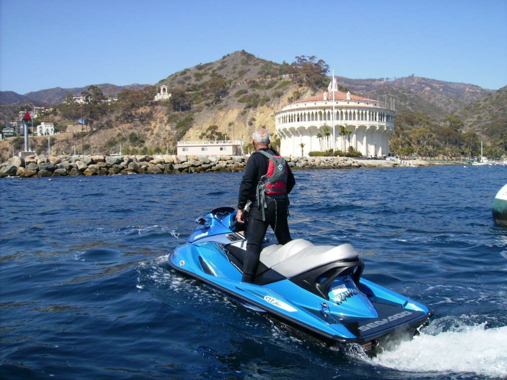
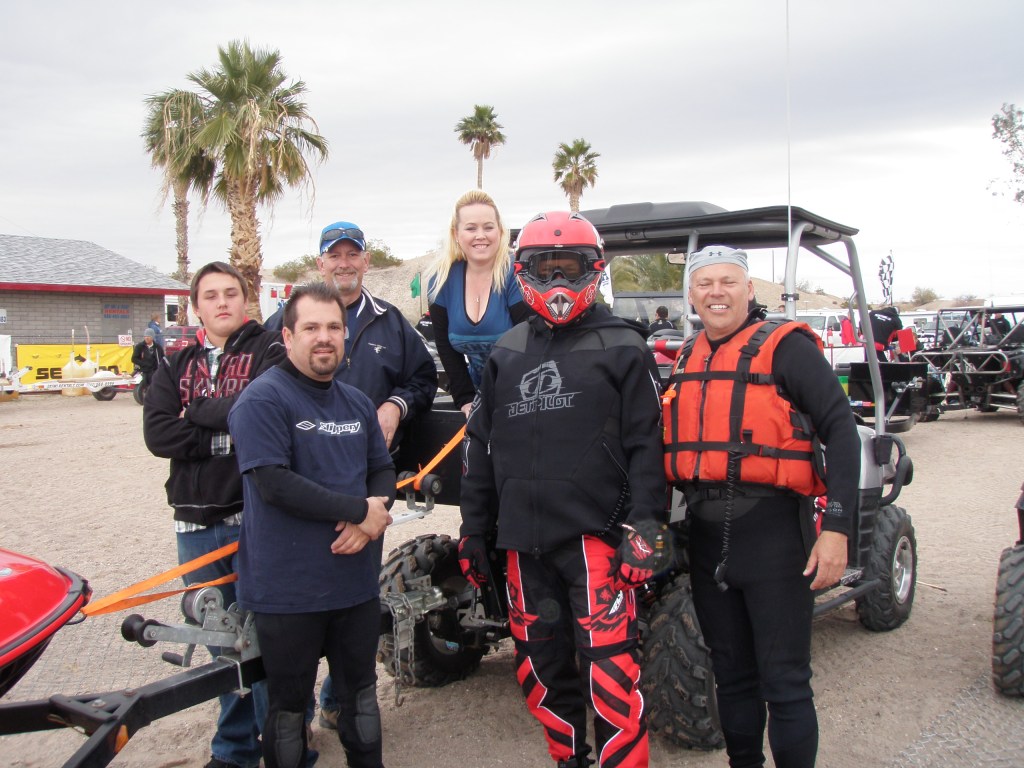
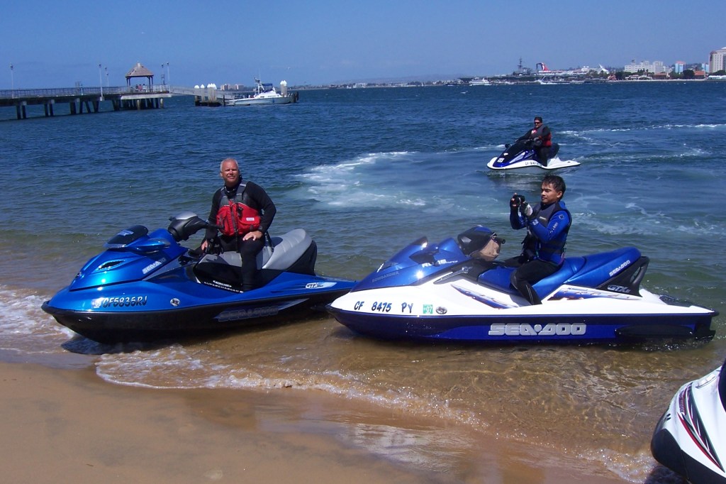
Enjoy the vintage random photos. Ahhhh the memories.